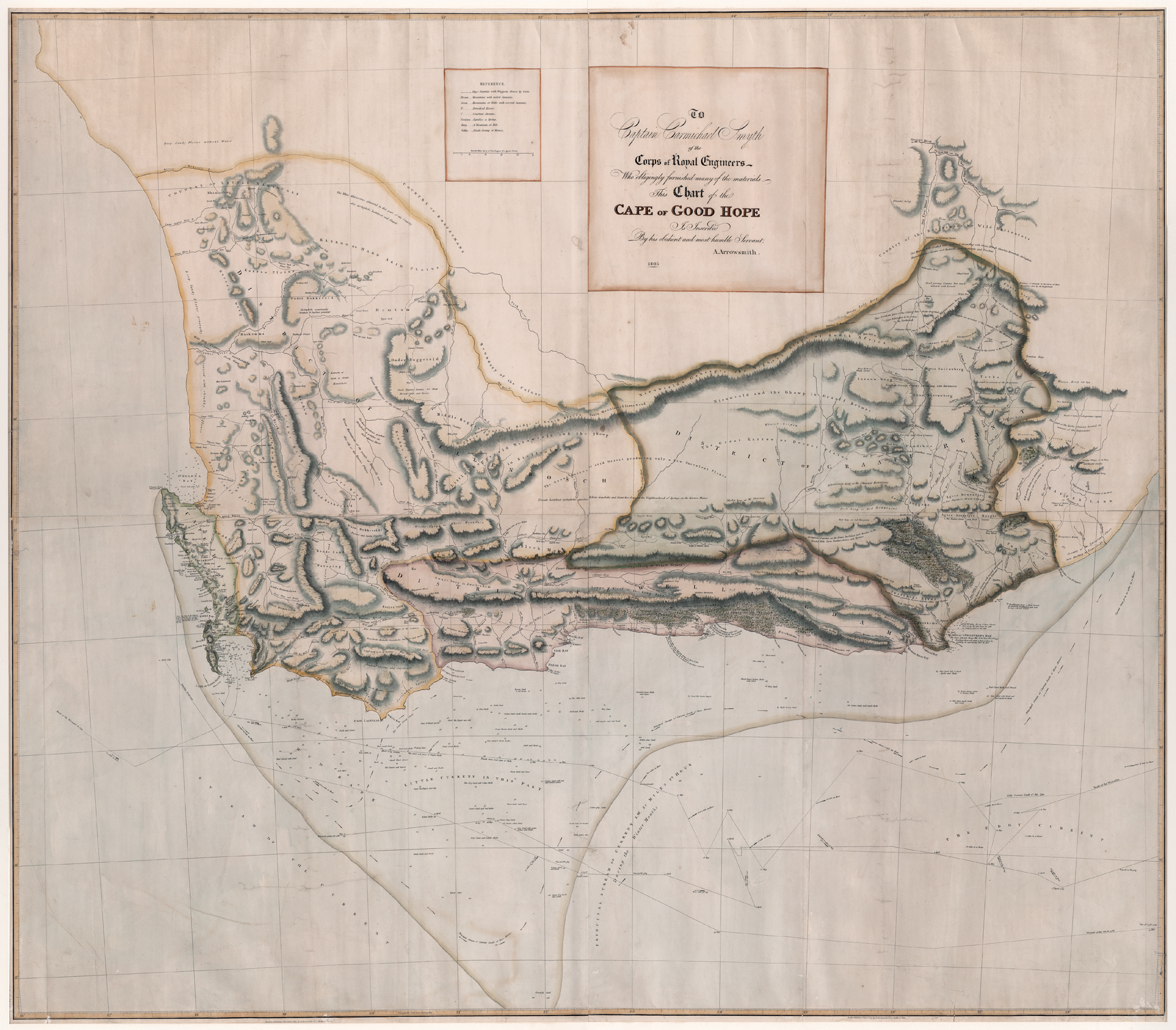
Aaron Arrowsmith (London, No 25 Rathbone Place, 1805); republished (No 10 Soho Square. Hydrgographer to H.R.H. the Prince of Wales, 1811).
This map was the first large-scale, adequate printed map of the Cape Colony. It shows the extent of the Cape Colony and its divisions up to the beginning of Batavian rule (1803).
The interior of the map is based on Barrow's map and includes many of his annotations on indigenous peoples, animals, vegetation and agriculture. The map also contains considerable new nautical information, presumably obtained from English hydrographers who were very active in the Cape seas after the British took occupation of the colony in 1795. Soon after this map was published, the colony was handed back to the Dutch, the Batavian Government and not the VOC, which had been liquidated after becoming bankrupt.
This large map is now scarce; it seems that only six institutions have the map and there has been only one sale in the past three decades, according to Antique Map Price Record.
