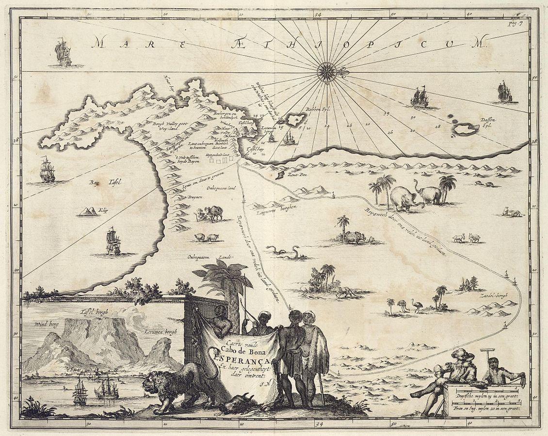
First image: Johan Nieuhof, Die gedenkwaerdige ... zee- en Lant-Reise door verscheide Gewesten van Oostindien .... (Amsterdam: Weduwe Jacob van Meurs, 1682).
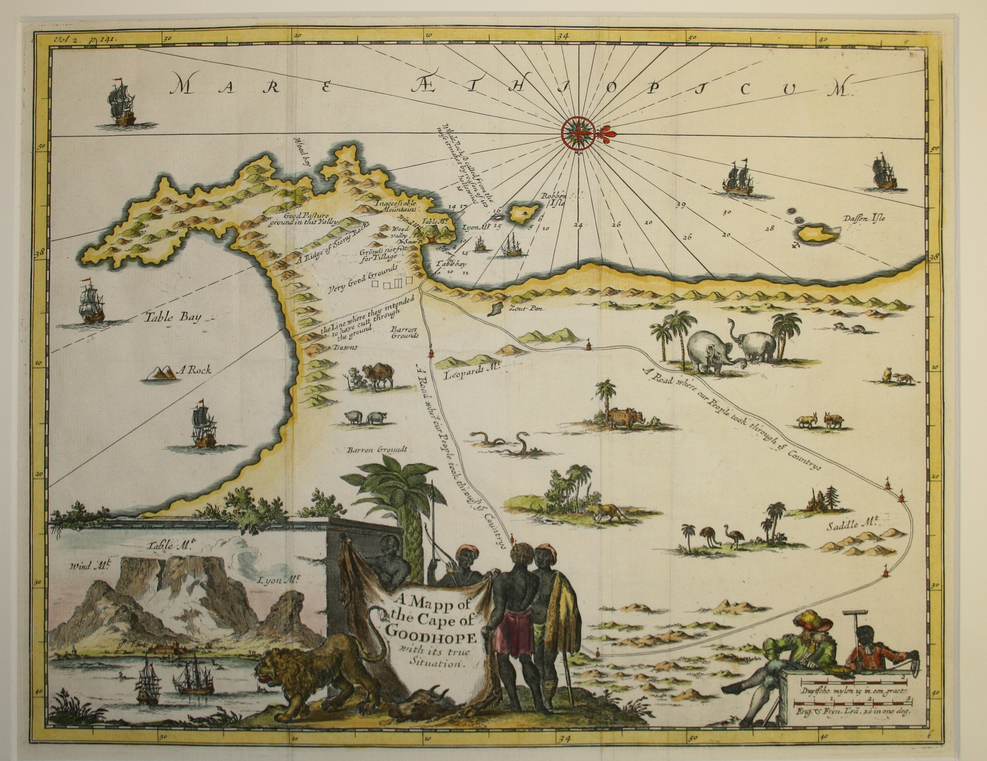
Second image: Mr. John Nieuhoff's Remarkable Voyages .... in Awnsham and John Churchill, A Collection of Voyages .... (London: 1704 & a number of times between 1732 and 1752)
Third image: Eric Walker, Historical Atlas of South Africa (Cape Town: Humphrey Milford Oxford University Press, 1922)
This is a scarce and historically important map. It is the first printed map to show the initial eastern expansion of the colony beyond the tiny village on the southern shore of Table Bay and also the first to show the routes of two of the earliest inland explorations by the VOC, under the command of Jan van Riebeeck.
Nieuhof worked for the VOC from 1660 to 1667 and visited the Cape in 1653, 1659 and 1671-1672, when the tiny settlement had not extended beyond the territory displayed on the map. Although the maps is said to have been engraved from Nieuhoff's drawings, it seems that Nieuhof based his drawings on a VOC manuscript map taken to the Netherlands in 1658 (NL-HaNA, Kaarten Leupe, 4.VEL, inv.nr. 846); the MS map probably was drawn by Pieter Potter, a surveyor on the journeys; consequently, the coastal outline of the Nieuhof map is a significant improvement on the Seller map (map # 2). Nieuhof added toponyms and comments on the agricultural suitability of the land and an artist added crude drawings of animals and trees, a cartouche and a prospect of the settlement.
In 1657, the VOC allowed some of its employees (Vryburghers - free citizens) to establish farms along the Liesbeeck River below the Wind Berg (Wind Mountain, now Devil's Peak) and the eastern cliffs of Table Mountain. These rectangular parcels of land were added by Nieuhof and are annotated as uytgedeelt lant (granted land) on the map. The map engraved for the English edition of Nieuhoff's journeys shows this development without annotation - see the second image.
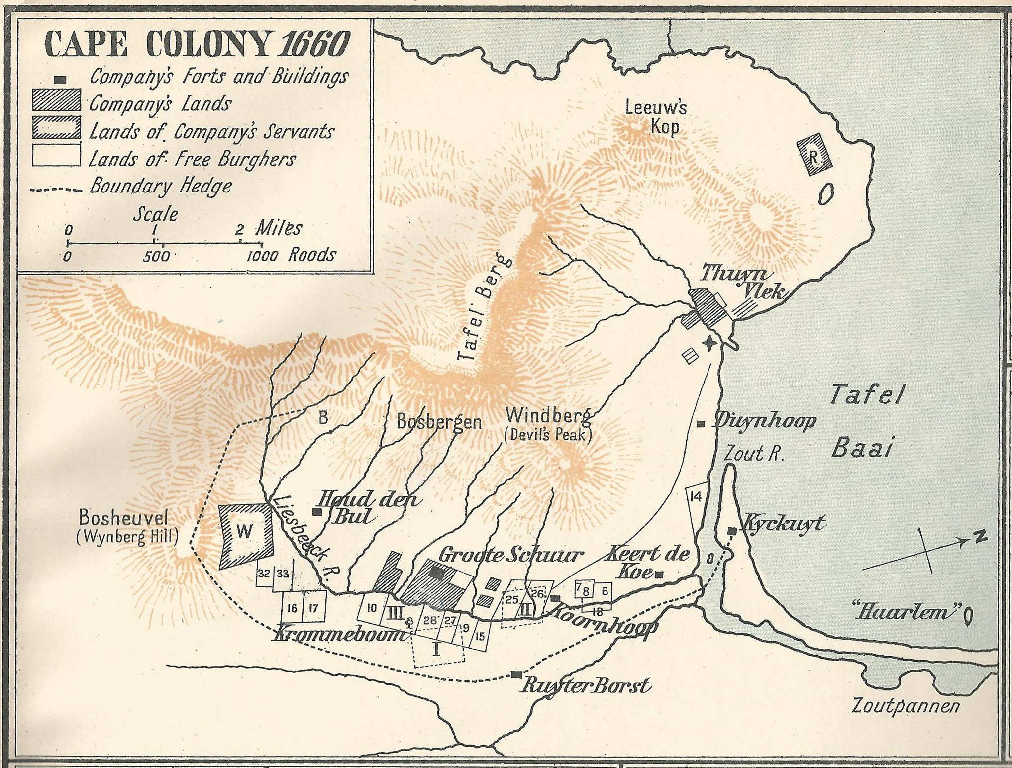
The actual position of the Liesbeeck settlement is more accurately seen in the third image (Walker's inset map of the colony in 1660); on this map, Vlek (old Dutch slang for a small settlement) is the village that became Cape Town; Thuyn is the Company (VOC) Garden. The line of the Boundary Hedge of the settlement is shown on Walker's map; part of what is now known as Van Riebeeck's Hedge (of Wild Almonds) is still growing on the Bosheuvel in the famous Kirstenbosch Botanical Gardens. The original land grants are now part of the densely populated suburbs of Cape Town.
Nieuhof's scarce map is also the first to show the route taken by some of the first VOC explorers: the routes shown on this map (Reyswech) are of Cpl. Muller's party in 1655 to explore the land to the east of the Vlek and Abraham Gabemma's party in 1657 to explore the north-east. The map also shows the canal between Table Bay and False Bay proposed, probably in 1657, by Rijckloff van Goens, a visiting VOC official; the canal was never constructed. Hout (Wood) Bay on the northern coast of the peninsula is identified for the first time on a printed map; the bay was one of the few sources of wood used in construction and it was later guarded by fortifications, the ruins of which still can be seen along today's scenic Chapman's Peak Drive. False Bay is incorrectly named Bay Tafel (Table Bay).
By the time Nieuhof's map was published, settlers had started to occupy land further to the east, e.g. the village of Stellenbosch (1674) - see Loots's 1698 map (map #4).
