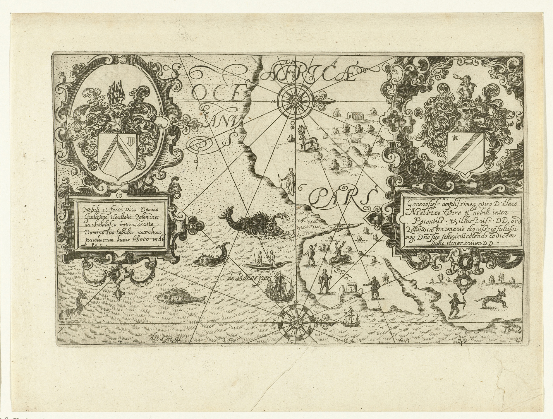
First illustrated map: 't Historael Journael ... van Joris van Spilbergen in Isaac Commelin's Begin ende Voortgangh van de Vereenighde Nederlantsche Geoctroyeerde Oost-Indische Compagnie. (Amsterdam: Johannes Janssonius, 1646); the illustrated map is the mirror image of the map used in the first publication of the 't Historael Journael (Delft: Floris Balthasarsz van Berckenrode, 1605).
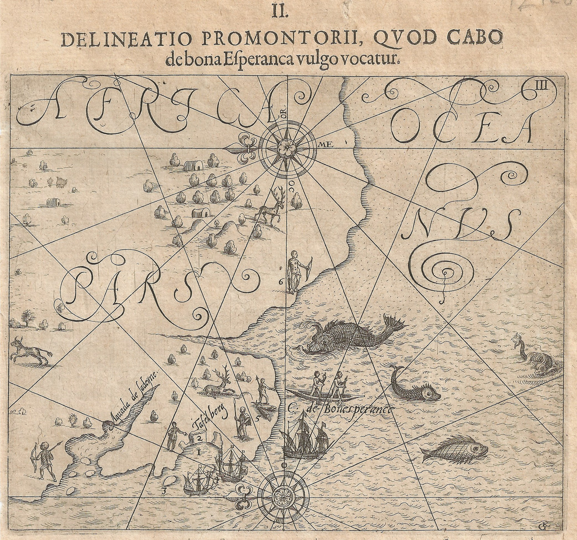
Second illustrated map, with the headline Delineato Promontorii, Quod Cabo de bona Esperanca vulgo vocatur [Map of the promontory, commonly known as the Cape of Good Hope], in Theodore de Bry, [Petit Voyages] Collectiones Indiae orientalis (Frankfurt: Wolfgang Richter, 1612), v.9, pl.3 (17cm x 14cm).
The first edition of the De Bry Map has the headline Warhafftige Abbildung deß Busems Toffel Baije genannt [A true representation of the Gulf called Table Bay]; it was published in [Petit Voyages] Collectiones Indiae orientalis (Frankfurt: Matthias Becker, 1605), v7, pl.3. The map was also published in other editons of Petit Voyages: with the headline Delineato sinus illius, quem Hollandi, sua lingua Taffel Baje, nominarunt' in 1606, v7, pl 3 and with the headline 'Abbildung der Cabo de Bona Esperanca' in 1612, v9, pl.3
Norwich #205 (De Bry map); not in Tooley; Margaret Cartwright; Europeana web page.
This map seems to be the first to depict only the Cape of Good Hope. It illustrated numerous publications of Joris van Spilbergen's travels, which he undertook from 1601 to 1604; the map is from the 1602 voyage, fifty years before the Dutch settlement was established at the Cape of Good Hope. The map is dedicated to Willem de Zoete and Jacques de Malderé, whose armorial shields decorate the map on the left and right respectively.
The numbers on the map, best seen on the De Bry edition, are explained in the text of Spilbergen's journal: 1. Table Bay; 2. Table Mountain 'which is seen 9 or 10 miles at sea'; 3. Isla d'Elizabeth (now Dassen Island); 4. Isla de Cornelia (now Robben Island); 5. Caep de bon Esperance; 6. 'These inhabitants have a clucking speech like turkeys (Khoekhoe, formerly known as Hottentot), and there are many harts and hinds (male and female deer) here' - from the translation by R. Raven-Hart.
The engraver of the Baltharsz map is unknown. The De Bry map was engraved by GK, i.e. Georg Keller.
