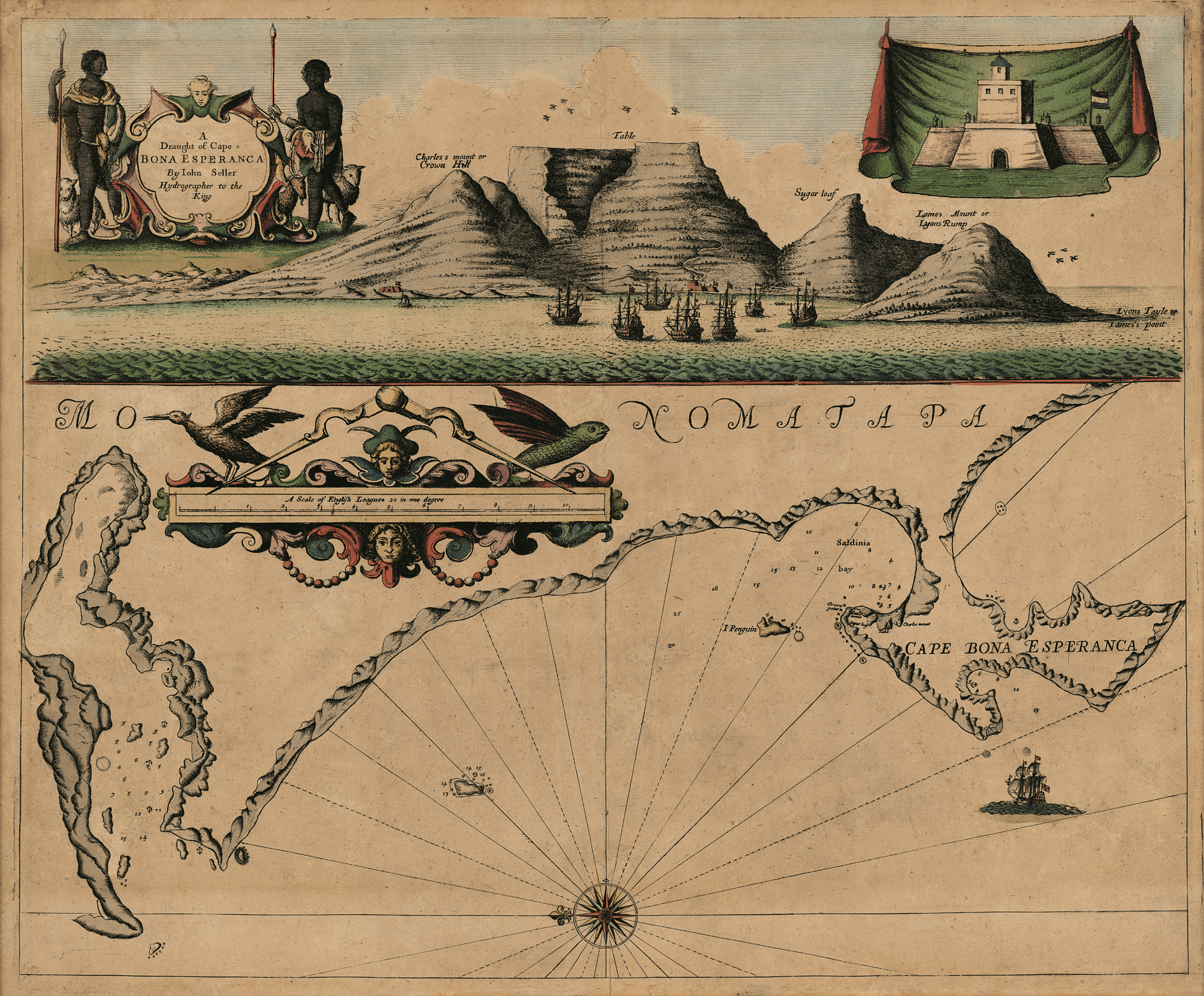
First map: English Pilot (Book V) and Atlas Maritimus (London: John Seller, 1675)
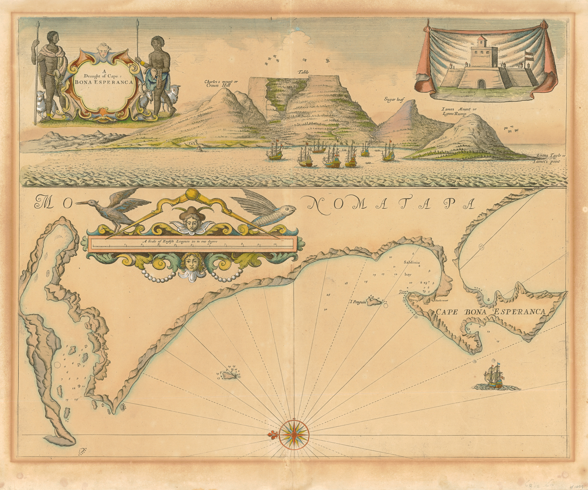
Second map: English Pilot (Book V) and Atlas Maritimus (London: Mount and Page, 1739) - second state of the 1675 plate
Third map: infra
Norwich #219 (different state); Tooley pp. 104 - 105; plates 77 & 78
This is the first English sea chart of the Cape of Good Hope, although it was derived from a Dutch source. The vignette above the chart also includes the much copied drawing of the small wooden fort.
On the maps from the 1675 plate (first image): I. Penguin is today's Robben Island; the unnamed island to the left (i.e. north) is today's Dassen Island; Green Point is named for the first time - now the site of Cape Town's controversial football stadium built for the 2010 FIFA World Cup. In 1703, John Thornton redrew the map and cartouche on a new plate: he eliminated Saldanha Bay at the 'Entrance to Saldina (sic) Bay', the major change; named Coney (i.e. Dassen) Island; changed Saldinia Bay to Table Bay; and added a key (A-P); this map is plate 78 in Tooley. In 1711, Samuel Thornton replaced his brother's name in the title with his own; in 1734, Bay of Falso and two annotations in the bay were added, but the Thornton imprint was deleted. In c. 1739, Mount and Page returned to the original (1675) plate, but deleted the Seller imprint (second image). All of these maps are scarce.
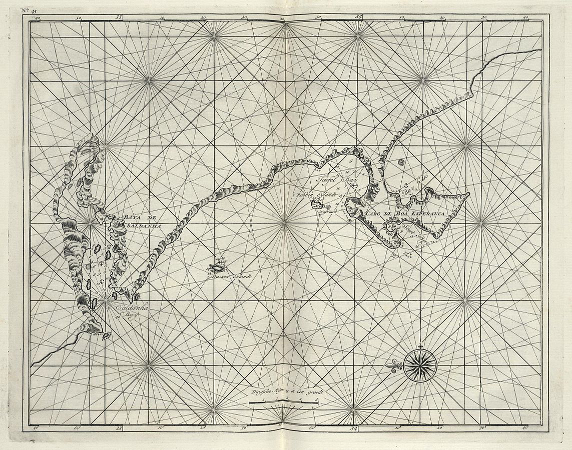
This very inaccurate map, with its grossly distorted coastline, was based on one of two Dutch manuscript maps from c. 1664: Kaart van Saldanhabaai tot de Falsbaai by Caspar van Weede (4.VEL 168 in the Dutch National Archives) or a similar map with the same title by Johannes Vingbooms (4.VELH 619.35 at the Dutch National Archives). Another printed version of the MS map was published in 1726 by François Valentijn in Oud en Nieuw Oost-Indien (third image) - see map #5 for publication details and for his other map of the region.
King James I of England had decided not to take possession of the Cape, when two captains in the English East India Company, offered it to him after they had laid claim to the land in 1620; consequently, the Dutch settled there in 1652. Seller's prospect of the early settlement captures the paradox: the English names of the mountains, which the English captains had assigned to them, and a symbol of the Dutch occupation: a Dutch flag atop the fort built in 1652. The fort was made of wood and mud and was replaced in 1679 by a stone fort known as The Castle (the oldest extant building in Cape Town).
