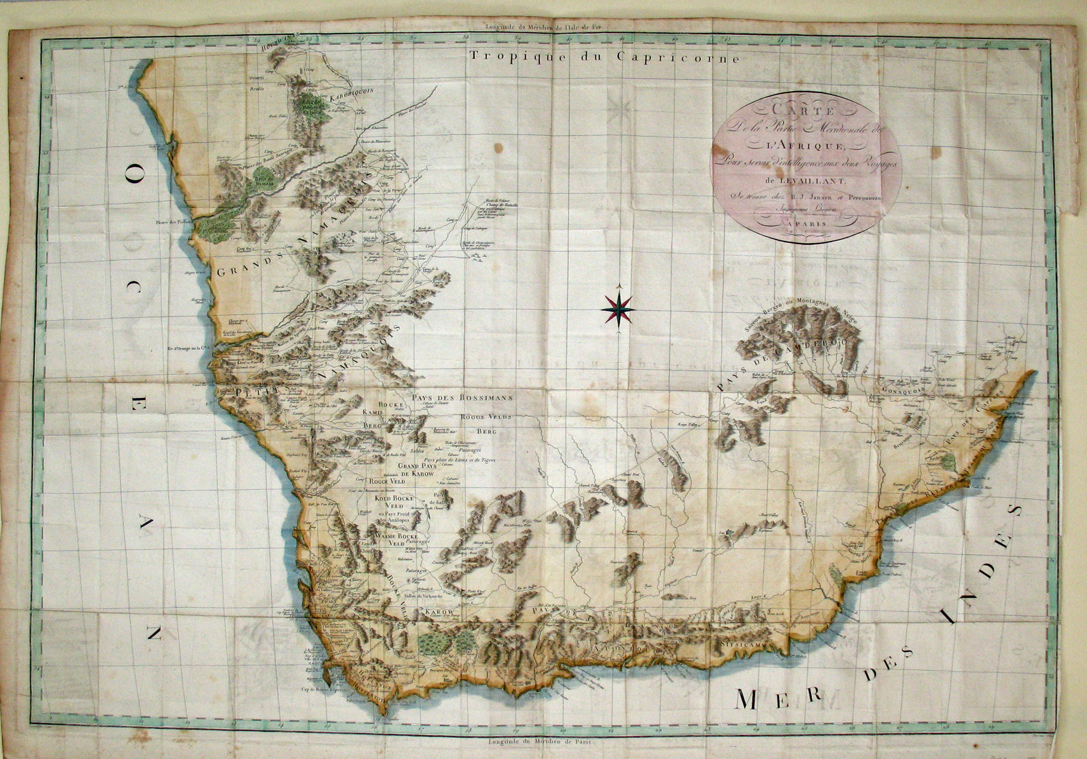
François Le Vaillant, Second Voyages dans l"interieur de l'Afrique par le Cap de Bonne Esperance, dans les annes 1783, 1784 et 1785. (Paris: H.J. Jansen et Comp., 1796).
Le Vaillant's map is the first printed map to show travel beyond the Orange River, to the north of the northern border of the Colony, into what would become South West Africa, now Namibia. The map also is notable and, perhaps, notorious for not being what Le Vaillant represented.
Le Vaillant was one of the more colourful naturalists in the Cape, who had a penchant for hunting; he travelled extensively in the Cape from 1781 to 1784. He was a better naturalist and storyteller than a geographer and there seems to be little substance behind his stated intent to produce a 'topographical plan' of the colony. Indeed, his map was produced eleven years after his return to France, in response to some criticism about the lack of a map in the popular first book on his voyages, which was published in 1790. Le Vaillant claimed to have used a quadrant during his travels, but Vernon Forbes (pp. 125 - 127), a geographer, doubted that Le Vaillant knew how to use one. After retracing Le Vaillant's routes, Forbes concluded that substantial parts of Le Vaillant's plotted routes were inconsistent with Le Vaillant's text, in some areas to have been unlikely and in others to have been impossible. Despite initial doubts, however, Forbes concluded from a drawing by Le Vailant and on the spot photographs that Le Vaillant's plotted route across the Orange River (at Ramans Drift) was genuine.
Much of Le Vaillant's map, but not his charted routes, was copied from the map of William Paterson, a plant collector who did no mapping and whose map was a very close, but poorly translated copy of Sparrman's map (see map #8). Le Vaillant's map was copied for the successive English, Dutch and German editions of his book.
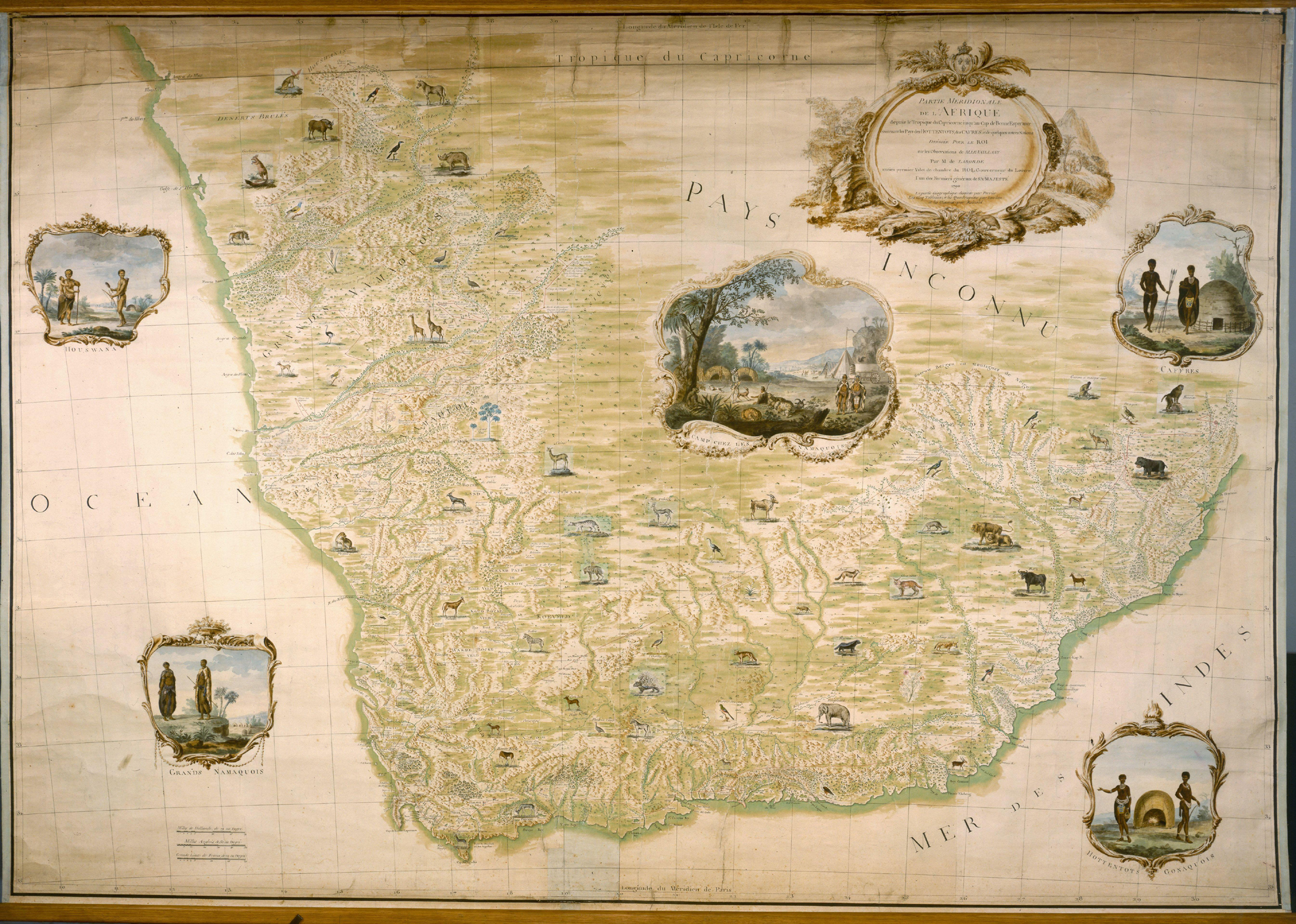
Le Vaillant's printed map is a reduction of a very large and beautiful manuscript wall map, now in the French National Library (Partie Méridionale de l'Afrique depuis le Tropique du Capricorne jusqu'au Cap de Bonne Espérance; second illustrated image). At least three artists, working under the direction of Jean-Benjamin de la Borde, produced a map that is a beautiful work of art. Le Vaillant also produced and had produced for him many beautiful illustrations, especially of animals, that are conserved in the South African Library of Parliament.
