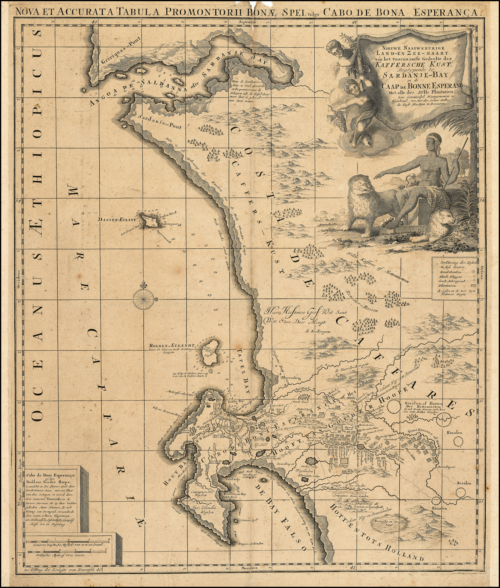
Nieuwe Naauwkeurige Land-en Zee-Kaart, van het voornaamste Gedeelte der Kaffersche Kust, Begrypende de Sardanje-Bay en de Caap de Bonne Esperanc (sic) met alle des Zelfs Plantazien [New and accurate map and sea chart of the Cape coast from Saldanha Bay to the Cape of Good Hope]
Johannes Loots. Amsterdam, c. 1698. Probably not included in a book.
Norwich #207 (attributed to Ottens, J); not in Tooley; Roger Stewart, Nieuwe en Naauwkeurige land- en zee-kaart, van … Caap de Bonne Esperanc(a), IMCoS Journal 136 (2014): 13 - 20.
This is one of the most important landmarks in the mapping of the Cape of Good Hope: the map is anonymous and undated, is very scarce, not well known and is important for both its historical record and its widespread influence on eighteenth century mapping of the Cape of Good Hope. Recent information has lifted some of the veil of mystery: the map was produced in 1698 by Johannes Loots in Amsterdam. Derivative maps were produced from 1710 until 1782 in The Netherlands, Belgium, France, Germany, Italy and Britain. The last derivative map was published in 1838 by James Wyld the Younger, 140 years after Loots's map was published.
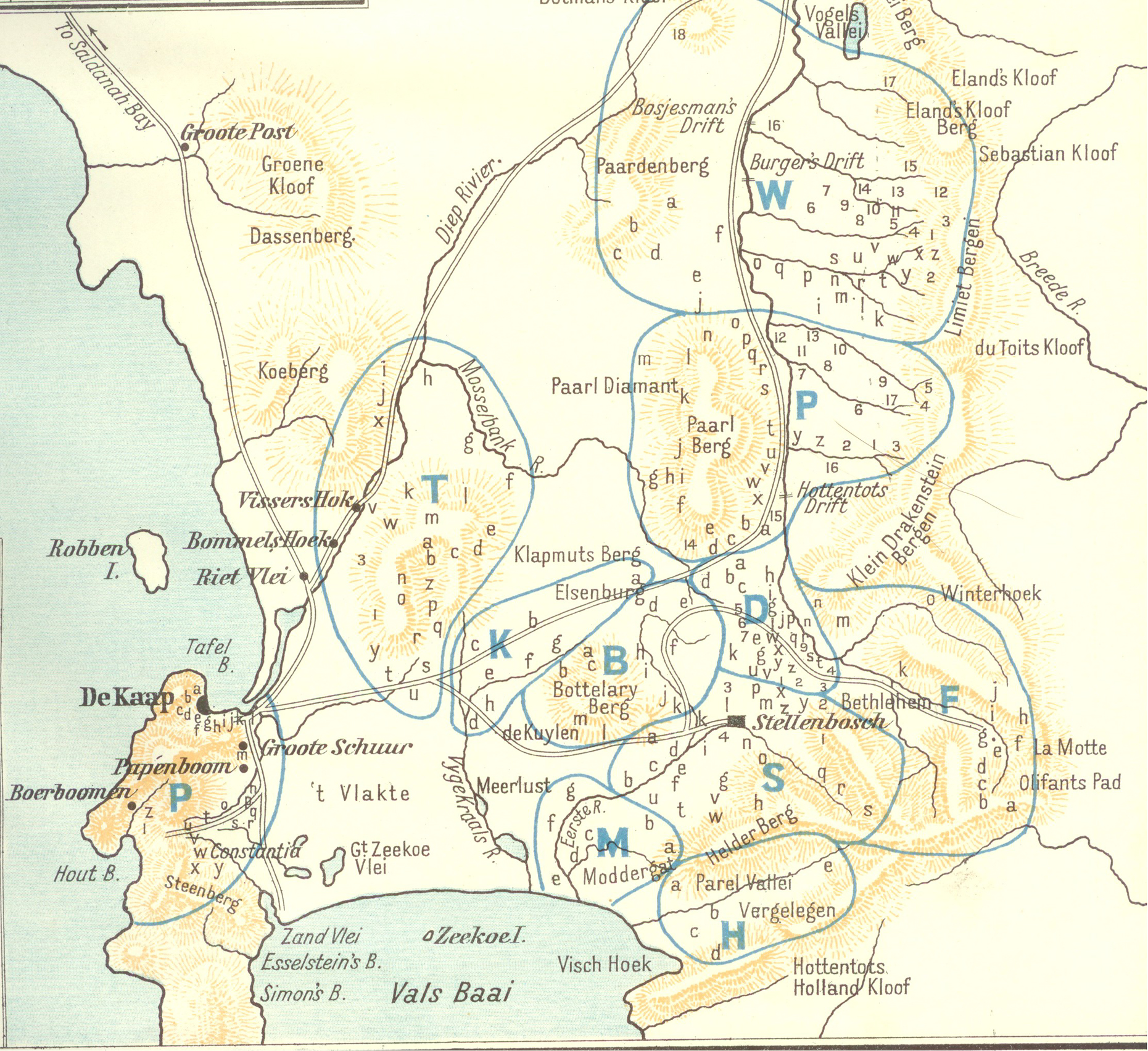
Nieuwe Naauwkeurige Land- en Zee-Kaart is of considerable historical importance from a number of perspectives. It was is one of the few printed maps derived directly from VOC manuscript maps and is also the first printed map to attempt accurately to depict the interior of the Cape of Good Hope: it shows the important, second eastward expansion of the colony across the sandy isthmus and the associated road network. More recently, this second eastward expansion was mapped by Eric Walker, the historian - see second image: most of the new farms recorded on Nieuwe Naauwkeurige Land- en Zee-Kaart were in areas S (Stellenbosch) and F (Franschhoek).
It was the first printed map of the Cape of Good Hope to use the name 'Hottentot' and to locate the areas in which these indigenous people lived; it provided a very concise history of the discovery and naming of the Cape of Good Hope and it explained why Saldanha Bay, a better harbour than Table Bay, was not the site of the first Dutch settlement; it was also the first map to depict the Renosterveld that once populated by numerous species of animals, such as the renoster, the Black Rhinoceros (Diceros bicornis), which is now locally extinct. Only 5% of the original area of the Renosterveld survives: a threatened part of the unique Cape Floristic Region .
