N-L De Lacaille, Diverses Observations Astronomiques et Physiques .... in Histoire de l'Académie Royales des Science Année M. DCCLI (1751) Avec les Mémoires de Mathématique & de Physique, pour la meme Année. Tirés des Registres de cette Académie. (Paris: De l'Imprimerie Royale: M. DDCCLV (1755), 398-456.
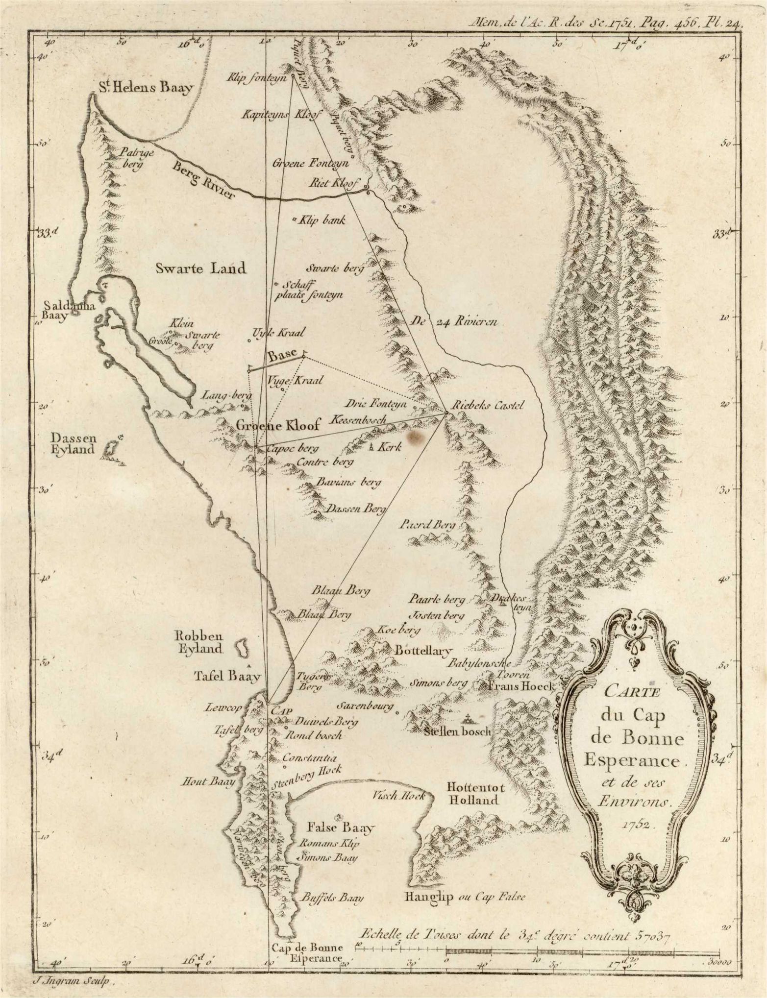
Due to a confusing publishing anomaly, the map illustrated Lacaille's article in the 1751 edition of the journal, which was published in 1755.
Norwich #220 (1763 edition of the map); not in Tooley; Roger Stewart, A mystery resolved. Lacaille's map of the Cape of Good Hope. IMCoS Journal 119 (2009): 7 - 11
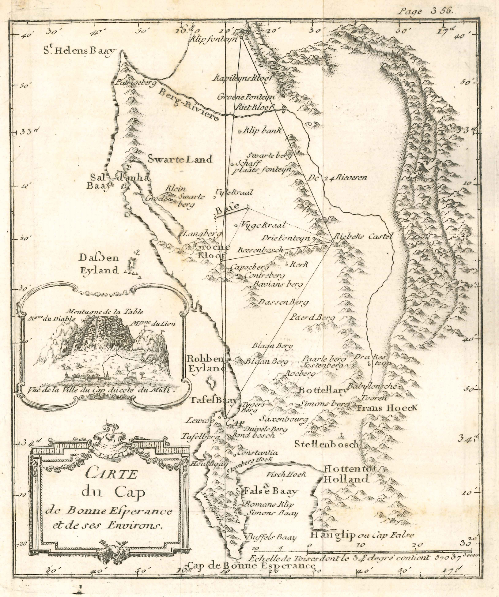
This small map signals the beginning of scientific surveying and cartography in Southern Africa. The most prominent and famous feature of Lacaille's influential map is its geodetic record: the date of the survey, which is captured in the title that is set within a decorative cartouche at the bottom right of the map; the geodetic triangles; and the result recorded above the scale bar, viz. 57 037 Toises (111.17km). The latter was the length of Lacaille's arc, across one degree of latitude ('at the 34th degree of South latitude'), of the terrestrial meridian through his observatory, about 600m north-west of Cape Town's Castle of Good Hope. The geodetic record is also known for its error (0.13km), which implied a slightly pear-shaped Earth. The error was caused by Lacaille's failure to take into account the effect of the gravitational force of nearby mountains on the plumb bob of his instruments; this effect was most significant at the northern and southern terminals of his survey.
Despite its French title, Lacaille's map is notable for its mainly Dutch toponymy. The coastline, which he did not survey, has significant errors in the north-west and south-east; the source of the errors is obscure: probably from a VOC map, which has yet to be identified. Nevertheless, the accuracy of the map was a vast improvement on the earlier maps. Lacaille's map had a great influence on mapping of the Cape and his survey established scientific surveying in the country.
The first edition of the map (1755), which was engraved by John Ingram, is very scarce. A new engraving of the map, with a tiny prospect of Cape Town, was published in Lacaille's posthumous Journal Historique (1763), inter alia; this map (see second illustrated map) is better known, but also is uncommonly available.
Lacaille's manuscript map of the Cape of Good Hope is in the Cape Town Repository of the National Archives of South Africa (M1/166).
