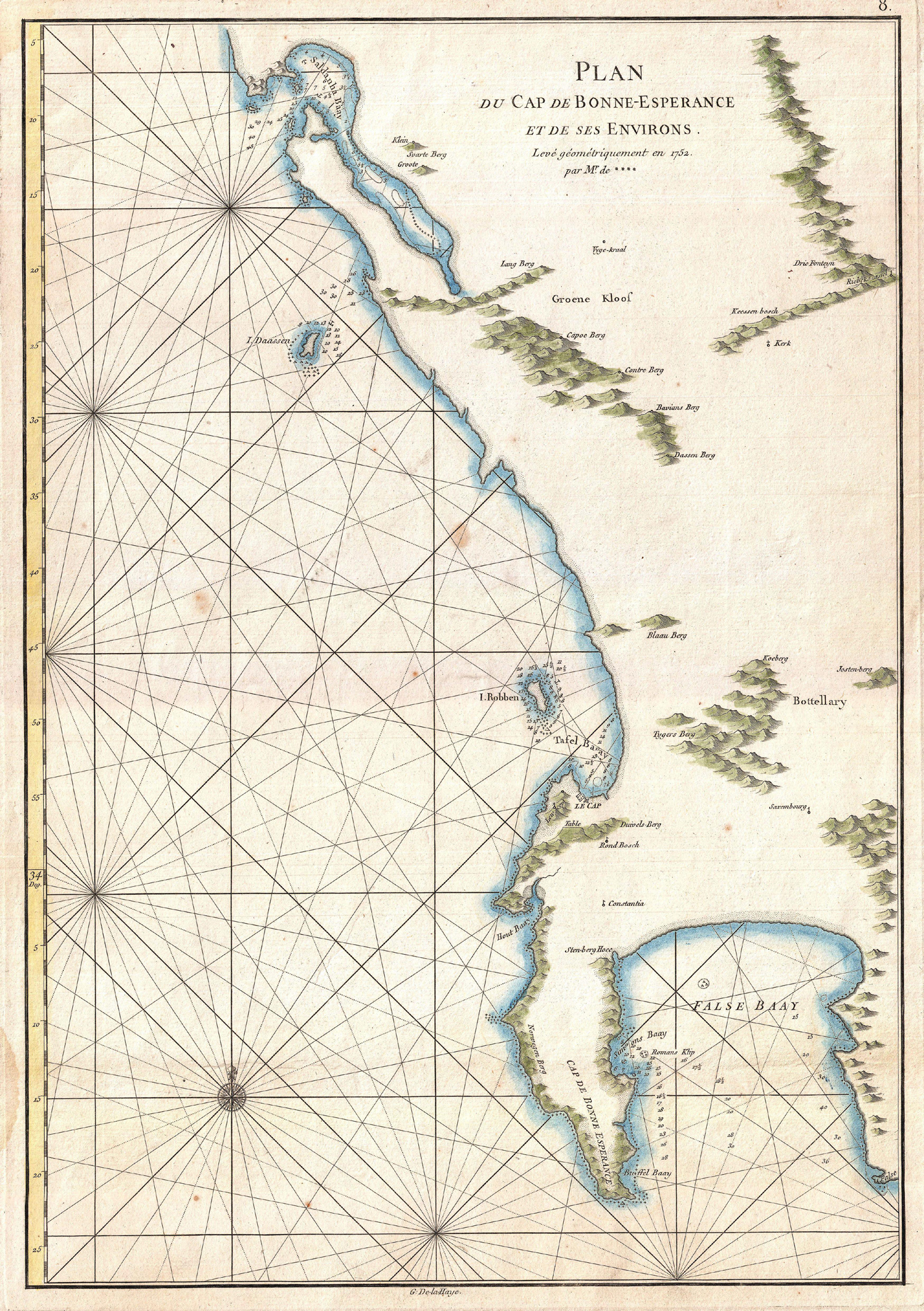
Plan du Cap de Bonne Esperance et de ses Environs. Levé géométriquement en 1752.par Mr. de **** [Map of the Cape of Good Hope and its surroundings. Surveyed geometrically in 1752 by Mr. de ****]
Jean-Baptiste Après de Mannevillette, Le Neptune Oriental: dedié au Roi and Instruction Sur La Navigation Des Indes Orientales Et De La Chine, Pour Servir Au Neptune Oriental: dedié au Roi. (Paris: Demonville; Brest: Malassis, 1775).
This is the first sea chart of the Cape of Good Hope and environs that does not have a grossly distorted coastline, although the coastline in the north-west remains somewhat distorted e.g. Saldanha Bay is too long. The map is based on the trigonomtric survey conducted by Nicolas Louis de Lacaille ('Levé géométriquement en 1752') - see map #6.
Jean-Baptiste d'Après de Mannevillette (1707 - 1780) was a captain in the French East India Company and a respected hydrographer. He is famous for his nautical atlas and manual, Neptune oriental, which first was published in 1745, without a chart of the Cape of Good Hope. In 1751, he commanded Le Glorieux on a voyage from France to the Cape of Good Hope; on board was l'Abbé Nicolas-Louis de Lacaille, the astronomer, geodesist and mathematician. Lacaille's main objectives for his visit to the Cape were to survey the southern skies and fix the position of Cape Town using astronomical methods (map #6).
After Lacaille disembarked at the Cape, Mannevillette continued with his mission to improve the charting of the route from France to the East Indies; his mission culminated in 1775 with the publication of the widely influential second edition of his Neptune oriental, which included this map.
